


.jpg)


.jpg)


.jpg)


Breakthrough in Firefighting Tech: Drones That Track Smoke and Forecast Fire Direction
AI: Researchers at the University of Minnesota have developed drones that analyze smoke particles to predict and prevent forest fire spread. After multiple failures, the team succeeded with drones that fly up to 150 feet and collect data for 25 minutes. The drones send real-time information to computers that estimate fire and smoke movement. Led by Professors Jiarong Hong and Krishnakumar, the project envisions an automated system where one central drone coordinates others, adapting to wind changes. This technology could make forest monitoring and controlled burns safer, offering a powerful tool to combat wildfires and protect the environment.
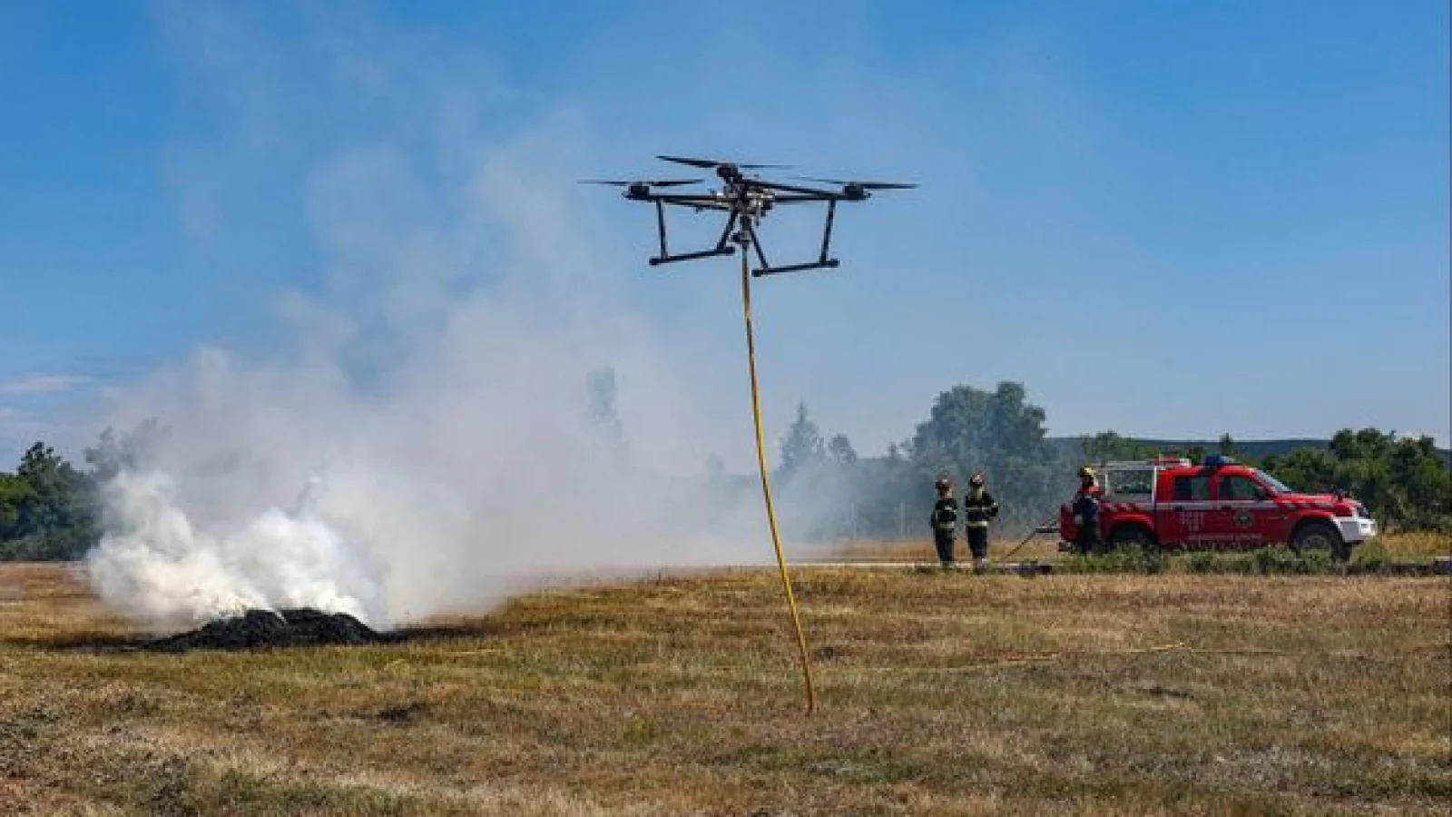
Due to climate change, forest fires are increasing in frequency. Controlling these fires is extremely difficult for humans. To address this challenge, scientists at the University of Minnesota have developed a specialized AI-powered drone that can analyze smoke and ash particles rising from a fire and estimate their speed and direction.
These drones collect data on the tiny particles in the air and immediately send it to a ground-based computer. With this information, the computer tries to estimate in which direction the fire might spread and where the smoke would reach. Says Professor Krishnakumar, "We want to understand how far the tiny smoke particles can travel and at what altitude they remain. This understanding will help prevent the spread of fires in the future."
The failure of several previous attempts finally gave way to success in this drone project. Its forerunners crashed multiple times, but the team came back with newer generations equipped with better sensors, larger propellers, and more powerful motors. Today, they can fly as high as 150 feet and continuously collect data for about 25 minutes.